This is a project I originally started for Jean,my mother. I had shown her photos of Antarctica and the Amazon, and she did not like them...except for a picture
of myself and Dave in our protective wear on the Antarctic ice. She wanted photos of me, and where I lived.
Sadly, I was slow in doing the work of taking the photos of my environment, of Perth and WA...
in fact I barely took some local photos before Jean passed away.
There are five people from my travels around the world, to whom I have told that Perth is paradise to me, and I have promised to send photos.
You are one of those. This is the first part, which is just an experiment to see how I go, and only includes Maylands,
which is the suburb in Perth where I live.
I plan to expand the whole story when I get another car, or a better/working bicycle.
To the right and below are Google-Earth images to show my place.
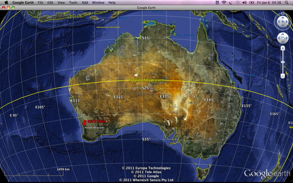
Perth is the capital city of Western Australia (abbreviatied to WA), located in the SW of Oz, and is the only green part of WA, the rest is desert. WA is the largest State in Oz, and occupies the whole of the left hand one third of the continent. Oz is roughly the same size and shape as USA.
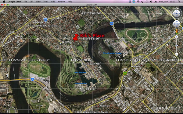
Maylands is in the shape of a peninsula. In fact the central road that runs down the center is called Peninsula Road.
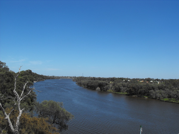
The Swan River flows around Maylands and makes a similar shape to the famous Isle of Dogs in London.
I live in the middle of the peninsula, and I am located about 400 meters from the river in both East and West directions,
which is a two minute walk or a one minute cycle...downhill, wheeeeeeee.
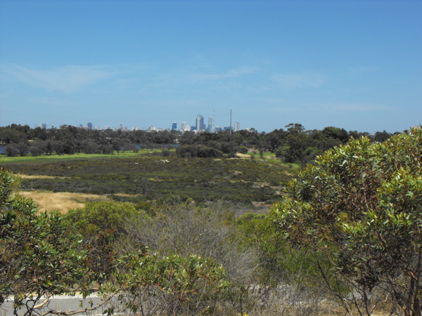
Where I live is at the top of the highest point in Maylands, and whilst it commands neat views of the Perth hills, and Perth City (particularly at night)
it is a bugger when I go for a bike ride, as no matter which direction I return home there is always a steep hill to climb...exhausting, particularly
at the end of a long ride.
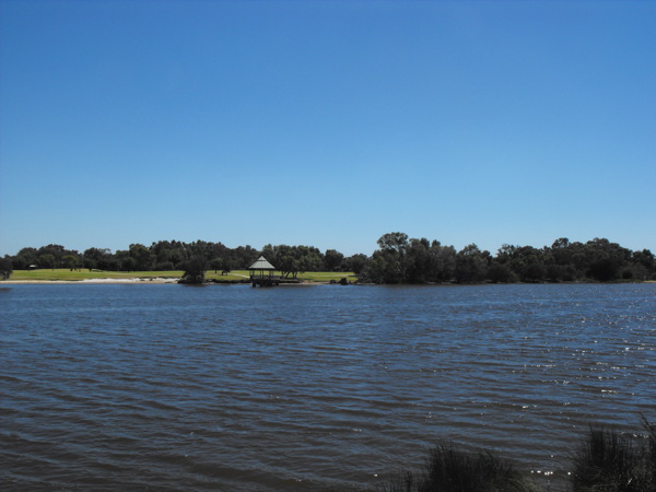
Maylands is very leafy and green. It has a full size 18 hole golf course down the western edge, together with bar and restaurant, good for Sunday dinner
when I have the cash. Round the south there are swamps and bird reserves, and up the middle are two lakes, which also attract many migratory birds during the
spring season. It is not unusual to see an Ibis crossing the road in Spring.
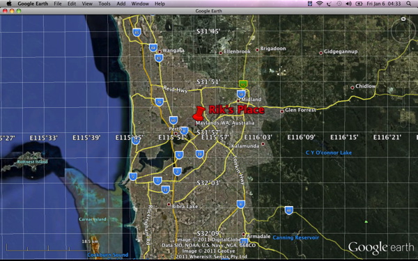
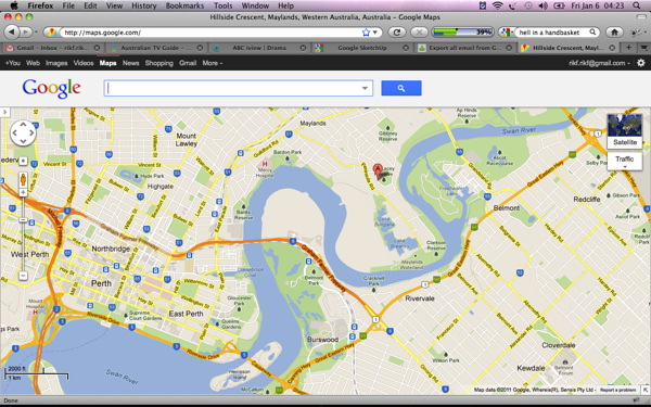
On the right is a map of Perth and Maylands environs.
The main city of Perth, the actual CBD (central business district) is between the three orange freeways and the river. The top orange freeway actually goes under
Perth in a tunnel, only surfacing again to join up with the others at top left.
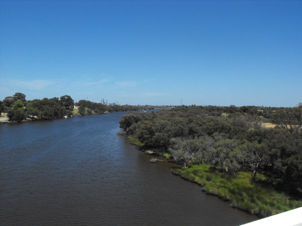
For those that enjoy Test Cricket, the WACA (WA Cricket Association) ground is located in the east of Perth near Herrison Island. I can se the WACA
lights from my place, and often listen to the rock concerts that play there occasionally, for free. The Police played there last year, and the closing
firework display was brilliant...hehehe, but Stevie Nicks was not so good.
Perth has a recorded population of 1.2 million people, but only about 100k actually live in the CBD.
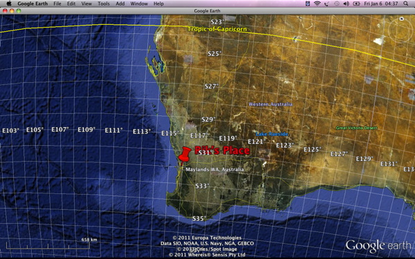
Perth spreads up the coast of the Indian Ocean for nearly 100km, and is only about 30km wide at it's widest (see the google earth image earlier.)
Maylands is very nicely located. When I first came to Perth (in 1974), it had nothing but open space and a landfill tip. Now it has developed and is considered inner-city living. Buses and trains get me into CBD in 30mins, and I can cycle in too. There are cycle tracks all along the river on both sides, which go all the way to Guildford...some 30km to the east.
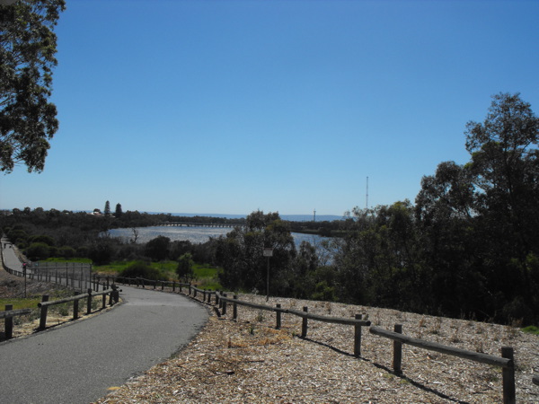
So, I jump on my bike, and roll down the hill to the east, and I arrive at the river, barely having pedalled at all. You can see the Perth hills in the distance. The cycle track drops down another hill to the river here. It is deceptively steep.
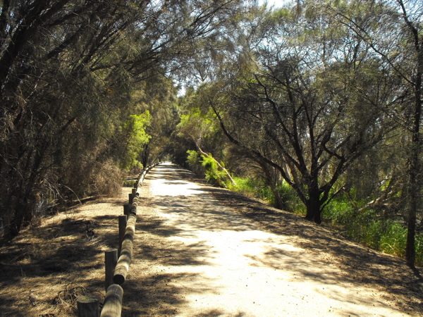
As I get to the bottom of the hill, I enter another swamp area where I often see blue tongue lizards, and there are many paper-bark trees.